Skip to content

基于Openlayer 的Control方式,仿照Arcgis desktop的Identify,包含所有动画和界面都非第三方插件

Notifications You must be signed in to change notification settings

DerekMar/openlayer-Identify

Folders and files

NameName
Last commit message
Last commit date

Latest commit


History

23 Commits


Repository files navigation

openlayer-Identify

基于Openlayer 的Control方式,仿照Arcgis desktop的Identify,包含所有动画和界面都非第三方插件

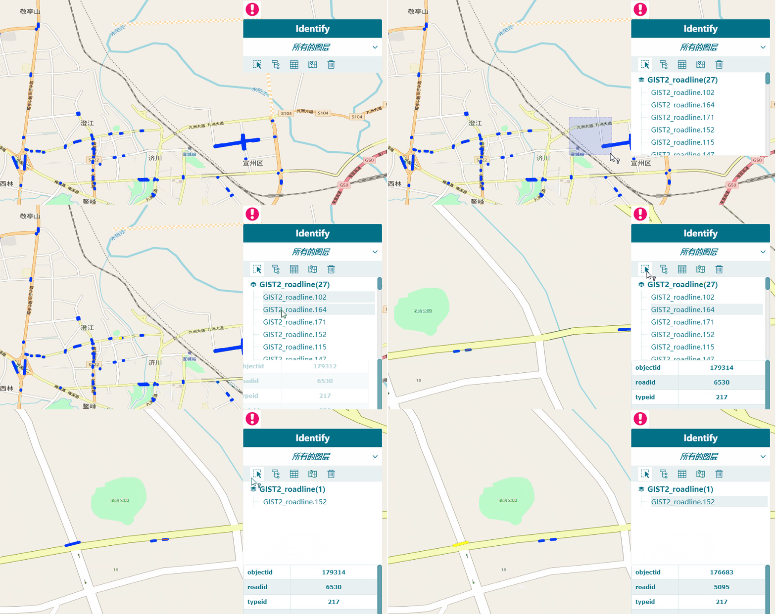
效果展示图 one

image

仿照Arcgis的功能特性

 1. 图层类型选择器,包括(所有图层、可见图层、最上面的图层以及图层树列表)  2. 工具栏(框选、隐藏树列表、隐藏表格、缩放至、清除)  3. 选择结果树状展示列表  4. 属性展示表格

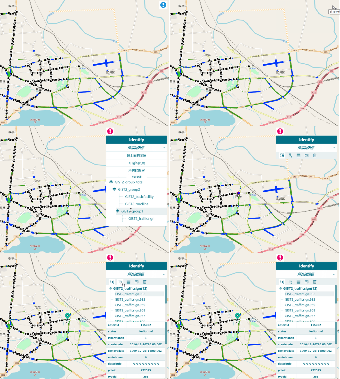
效果展示图 two

image

地图图层的点动画

 1.采用css动画,避免数据加载太多,导致卡顿  2.仿照抛物线

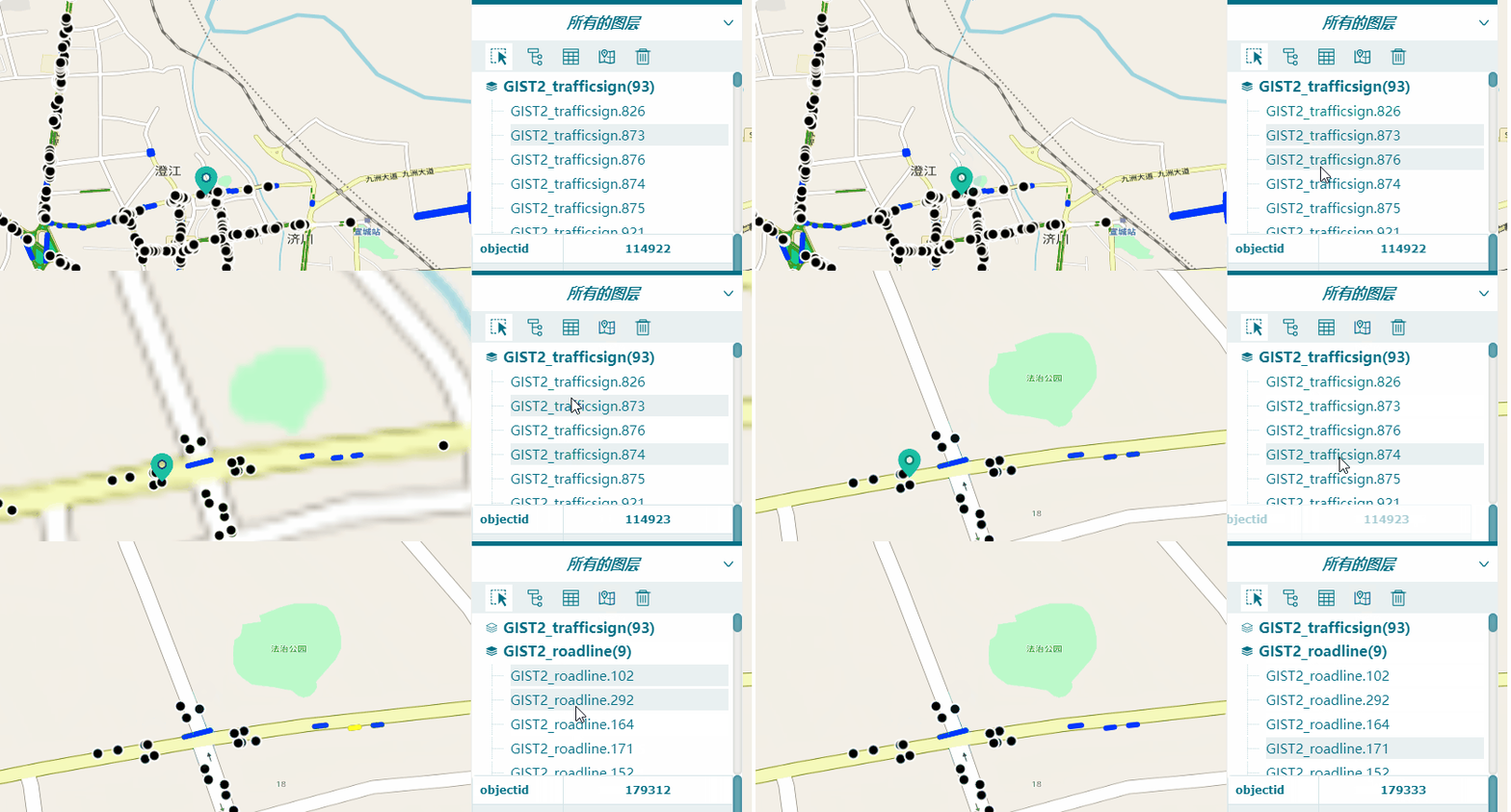
效果展示图

image

支持点选和框选

 1.支持框选,框选下能查找最上面的图层  2.支持点选,点选下查找最上面图层,只能得到一个

额外

 包含了select组件、树状列表组件、表格组件、工具栏组件,均为没有引入第三方插件

使用方法

  1. 引入ol-Identify.js (暂时没有上传到npm上)
  2. 在地图初始化后,初始化我们的control组件,并展示,如下:
import Identify from './js/Component/Identify/ol-Identify';
let identify = new Identify({
   // position: "bottom" //这里可以设置一下位置 top 或者bottom,默认是top
});
map.addControl(identify);
identify.showIdenditfy();
About

基于Openlayer 的Control方式,仿照Arcgis desktop的Identify,包含所有动画和界面都非第三方插件

Resources

Stars

Watchers

Forks

Releases

No releases published

Packages

No packages published