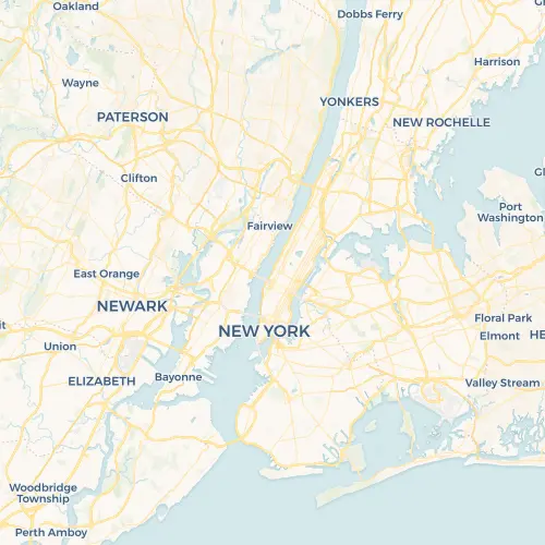
A containerized web version for staticmaps with express.
To get a static map from the endpoint /staticmaps several prameters have to be provided.
center- Center coordinates of the map in the formatlon, latzoom- Set the zoom level for the map.width- default300- Width in pixels of the final imageheight- default300- Height in pixels of the final imageformat- defaultpng(e.g.png,jpgorwebp)
For different basemaps docker-staticmaps is using exisiting tile-services from various providers. Be sure to check their Terms of Use for your use case or use a custom tileserver with the tileUrl parameter!
basemap- default "osm" - Select the basemaposm- default - Open Street Mapstreets- Default Esri street basemapsatellite- Esri's satellite basemaphybrid- Satellite basemap with labelstopo- Esri topographic mapgray- Esri gray canvas with labelsgray-background- Esri gray canvas without labelsoceans- Esri ocean basemapnational-geographic- National Geographic basemapotm- OpenTopoMapstamen-toner- Stamen Toner black and white map with labelsstamen-toner-background- Stamen Toner map without labelsstamen-toner-lite- Stamen Toner Light with labelsstamen-terrain- Stamen Terrain with labelsstamen-terrain-background- Stamen Terrain without labelsstamen-watercolor- Stamen Watercolorcarto-light- Carto Free usage for up to 75,000 mapviews per month, non-commercial services only.carto-dark- Carto Free usage for up to 75,000 mapviews per month, non-commercial services only.carto-voyager- Carto Free usage for up to 75,000 mapviews per month, non-commercial services only.custom- Pass through the tile URL using parametertileurl
with Docker
docker run -d --name='static-maps-api' -p '3003:3000/tcp' 'mxdcodes/docker-staticmaps:latest'
with Node.js
git clone https://github.com/dietrichmax/docker-staticmaps
npm i
npm run starthttp://localhost:3000/staticmaps?width=300&height=300¢er=-119.49280,37.81084&zoom=9&format=png
http://localhost:3000/staticmaps?width=500&height=500¢er=-73.99515,40.76761&zoom=10&format=webp&basemap=carto-voyager
http://localhost:3000/staticmaps?width=500&height=500¢er=-73.99515,40.76761&zoom=10&format=png&tileUrl=https://server.arcgisonline.com/ArcGIS/rest/services/Canvas/World_Light_Gray_Base/MapServer/tile/{z}/{y}/{x}


