-
Notifications
You must be signed in to change notification settings - Fork 11
Home
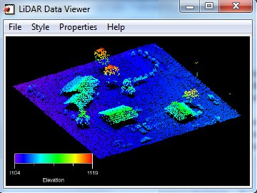
BCAL Lidar Tools are open-source tools for processing, analyzing and visualizing lidar data. They are written in the IDL programming language. The tools can currently process lidar data up to LAS 1.3 format.
Download Compiled Version
bcal_lidar_tools_envi52
bcal_lidar_tools_envi52_classic
bcal_lidar_tools_envi53
bcal_lidar_tools_envi53_classic
We no longer support the IDL Virtual Machine version of our tools LiDARTools_2.x.x-dev11-idl_vm
Installation Instructions
- Follow the installation instructions here.

Using the Tools
- Sample Lidar Data: To download sample datasets, visit the USGS or OpenTopography websites.
Citing the Tool
-
To learn how to properly cite the BCAL Lidar Tools in your publications please visit our citation page .
-
Also when you cite the BCAL Lidar Tools please use the contact information below so we can add you to our tool usage page.
Bug Report/Feature Request
- If you have found a bug or issue with the tools, or would like to request a new feature to be added to the tool, please submit an issue or feature request in the issue tracking system.
Earlier versions
- BCAL Lidar Tools were originally developed by Dr. David Streutker and are distributed through http://bcal.boisestate.edu/tools/lidar/. BCAL Lidar Tools have also been used by Harris Geospatial Solutions (formerly Exelis and ITTVis) to develop their own proprietary lidar extension for ENVI.
Request
- The BCAL Lidar Tools are widely used by a variety of university, federal and state agencies for research and teaching throughout the world. If you are using it for research or teaching purposes, please send the link to your work (e.g. publication/product/course) to bcal@boisestate.edu.
Development
- BCAL Lidar Tools are under active development. If you want to contribute in code development, please feel free to contact us.
Boise State University
1910 University Drive
Boise, Idaho 83725-1535
Phone: 208-426-2933
Email: bcal@boisestate.edu
http://bcal.boisestate.edu/
- Home
- Installation Instructions
- Processing Guide
- Tools Overview
- How to Cite
- [List of Publications] (https://github.com/bcal-lidar/tools/wiki/toolsusage)
Tool Overview - Preform Height Filtering
- Assign Vegetation Height
- Reassign LAS Classification From Vegetation Height
- Create Raster Products
- Las File Utilities
- Get LAS Header Info
- Get LAS Data Info
- Add Projection to LAS File(s)
- Reproject LAS File(s)
- [Change Z Unit of File(s)] (https://github.com/bcal-lidar/tools/wiki/Change-Z-Unit)
- Convert Ascii Data to LAS
- Convert LAS Data to Ascii/Shapefile
- Create Boundary EVF/SHP/KML
- Buffer LAS Files
- Tile LAS File(s)
- Reclassify LAS File(s)
- Decimate LAS File(s)
- Subset LAS File(s)
- [Export LAS File(s)] (https://github.com/bcal-lidar/tools/wiki/ExportLAS)
- Create Vegetation Height Groups
- Create Elevation Profile(s)
- 3D Lidar Viewer