SRTM
SRTM stand for Shuttle Radar Topography Mission and refers to a worldwide Digital Elevation Model (DEM) produced by the NASA.
This is one of the most common relief dataset, resulting of an international effort with some derivative products distributed for free.
The dataset is not totally worldwide because it cover only latitudes from 56°S to 60°N. The resolution of the dataset available to public usage is about 90 meters by pixels (30 meters for the USA only). So the Get SRTM function can not provide data in higher resolution. If you need better resolution you may search for others datasource, some country provides local DEM as opendata, otherwise you will certainly have to pay it.
More informations about SRTM dataset : https://www2.jpl.nasa.gov/srtm/
The operator named Get SRTM is a nice shortcut to grab SRTM relief data for a particular location. This functionality rely on third party web services that provides API to request SRTM data.
Taking this into consideration, this functionality highly depends on third party and so, can be broken at any time (server closed, in maintenance or overloaded). It also rely on your internet connexion and can fails due to any network issue (no internet, instable connexion, proxy of firewall missconfiguration).
Keep in mind, SRTM data can be downloaded in geotiff format from NASA / USGS web site and then imported into Blender with the import Georaster DEM operator of BlenderGIS (This is what the Get SRTM function do automatically under the hound). Importing geotiff data is a core functionality of BlenderGIS, you can import any kind of DEM dataset found over the web.
For the moment, 2 providers are available to serve SRTM data (ore providers can be added in the future) :
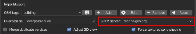
You can select your the provider to use in the addon preferences :