Recording shadow measurements
LTVT function details.. Main Screen.. Right click image menu..
The results of shadow measurements can always be read out interactively in the mouse readout panel. The current readout can also be annotated on the image by choosing the Record shadow measurement after right-clicking at the measurement point. In addition, the results, including the true distance of that point from a fixed secondary reference point, can be recorded to a disk file if such a file has been initiated with the Circle Drawing Tool. For a crater, the data in the disk file can be visualized using the Crater Shadows Simulator utility program.
(click on the thumbnails to see full-sized screen shots -- use your web browser's BACK button to return to this page)
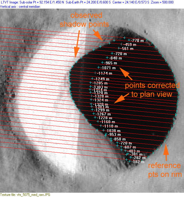
At the time of the shadow photo, the spacecraft was positioned to the north and west of the crater causing low points within the crater to appear closer to the NW rim than they should:

The LTVT shadow measurement tool corrects for this perspective effect by projecting the shadow points out to a sphere at the same lunar radius as the crater rim:
Points recorded to north of center:
Points recorded to south of center:
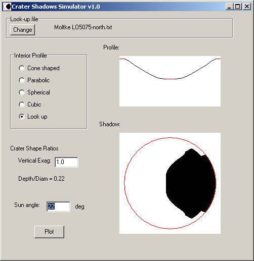
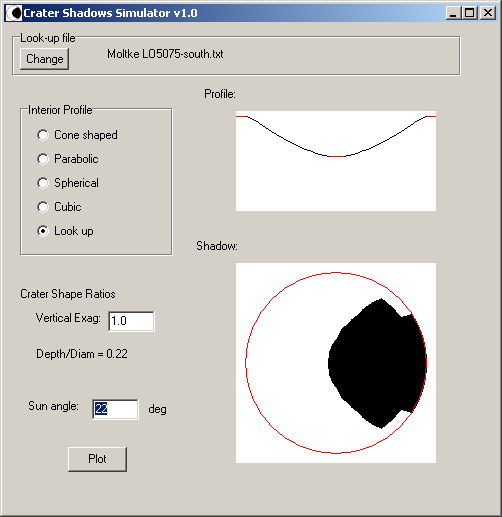
Plotting with the Crater Shadows Simulator
Profile of northern interior points and prediction of shadow as it would appear in plan view:
Profile of southern interior points and prediction of shadow as it would appear in plan view:
This page has been edited 2 times. The last modification was made by -  JimMosher on Nov 7, 2008 4:06 pm