Repository navigation
Releases
Releases · 248Tech/litemap
LiteMap v1.0.0

LiteMap measures any site from satellite imagery, so you can skip the site visit. It's a self-hosted web app with zero dependencies and an OpenAPI 3.1 REST API.
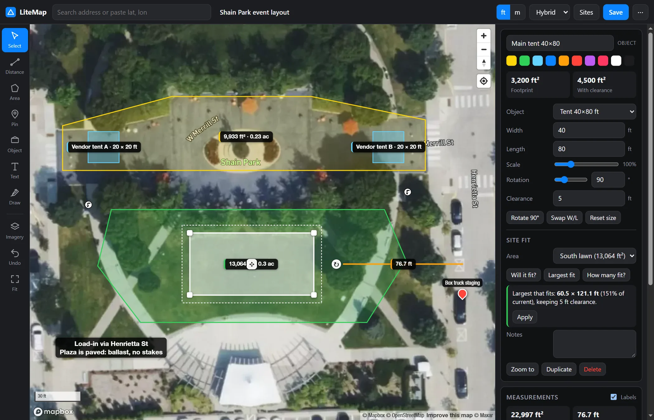
Highlights
- Measure: distances with segment totals, plus areas in ft² and acres or m² and ha, with perimeter. Snapping and full undo.
- To-scale objects: 46 built-in objects, including tents from 10×10 to 100×200 ft, stages, vehicles, trailers, containers, equipment, and courts. Each has a clearance setting for stakes and egress.
- Site fit:
- Will it fit? places the object where it has the most margin.
- Largest fit finds the biggest size that still fits.
- How many fit? packs a grid and draws the layout.
- Upload your own objects: on-device AI cuts the object out of a photo and crops it. Click the object or drag a box around it, then set its real size or stretch it to exact dimensions.
- Newest imagery: overlay Esri, Wayback, NAIP, 3-inch county aerials, NASA GIBS, or the SkyFi archive. Each source is ranked by its real capture date at your site. Optional sharpening and AI enhancement.
- Annotate and share: pins, text boxes, freehand drawing, links, GeoJSON or CSV export, and static satellite snapshots.
- Integrate: REST API with Swagger UI, API keys and CORS. An embeddable iframe can be driven with
postMessage.
Install
Requires Node.js 22.9+ and a free Mapbox public token.
# from the zip below, or: git clone https://github.com/248Tech/litemap.git
cd litemap-1.0.0
cp .env.example .env        # set MAPBOX_TOKEN=pk.…
npm start                   # → http://localhost:8787
No npm install and no build step. A Dockerfile is included.
Downloads
litemap-1.0.0.zip: runtime files only (server, web app, models, docs). SHA-256:ad7c826dcb919f9b2451ea9efd8a99b435141c47158acd91ca1375bf592773fc- Source code (zip / tar.gz): the full repository, including tests and the website
📖 Website · README · Changelog
Measurements are quote-grade, not survey-grade: accuracy is limited by the imagery (typically 1–3 m). Verify critical clearances on site.