Repository navigation
6. KML
Keyhole Markup Language (KML) is a standard based on XML markup language, which allows representing geographic data that specify a characteristic, such as a specific position. KML has been created to be used with Google Earth, which was the first program capable of graphically viewing and editing KML files. A KML file includes specifications for various functions to display in Google Earth or Maps and other three-dimensional Earth programs or geo browser.
The KML feature set includes placemarks, 3D models, text descriptions, images, polygons, etc. Each location has an associated longitude and latitude, and view-specific data such as heading, altitude, and tilt can be provided to define the so-called "camera view" for geospatial data. KML shares part of its grammar with the Geography Markup Language, or GML, an Open XML markup language defined to express data and geographic features. KML documents are often distributed in the form of KMZ files, which are nothing more than a compressed KML document within a file with a kmz extension. A KMZ file generally contains a single KML document, invariably called "doc.kml" along with overlay images and icons that you can refer to internally.
Here is an example of a KML file:
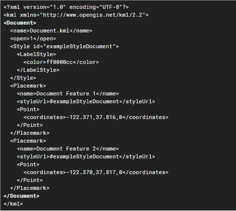
The example shows only the Placemark label with the coordinate point (longitude, latitude, altitude). Style defines colors, icons, sizes, ... and needs to be defined with when creating the placemark. There are other features, geometries, abstract views, ... All KML elements allow you to create files with a wide variety of options that, once launched in Google Earth in Liquid Galaxy, generate a spectacular viewing and experience for the user.