Repository navigation
setup
For the club officer who stands the event up, not the volunteer holding a link. The volunteers' pages are here.
Everything here happens in a browser at /setup. Two things stay in a
terminal and nothing else: your club callsign in a file called .env, and
starting the server.
Setting up, in four parts
- The course - you are here
- Roster and links - the people, and how they get in
- Race week and after - tracking, the rehearsal, the report
- Making it yours - layers, roles, and what else this can do
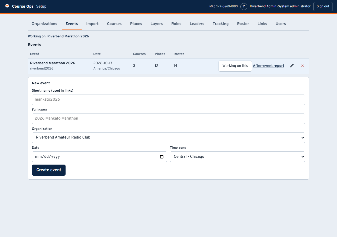
The tabs run roughly in the order you will use them. Every tab except Organizations, Events and Users belongs to one event - the one named in Working on: at the top.
An organization is your club. It owns its events and its administrators and cannot see another club's - so a second club on the same server is properly walled off, not just tidily separated.
Then Events: a short name, a full name, the date, and the time zone. Get the time zone right, because every clock in the app and in the after-event report is drawn in it.
The short name is permanent. It is in
/e/<short-name>/<link>, which means it is in every link you have handed out. The full name can be changed whenever you like; the short name cannot, because changing it would 404 every volunteer at once, silently, on the morning they need it.
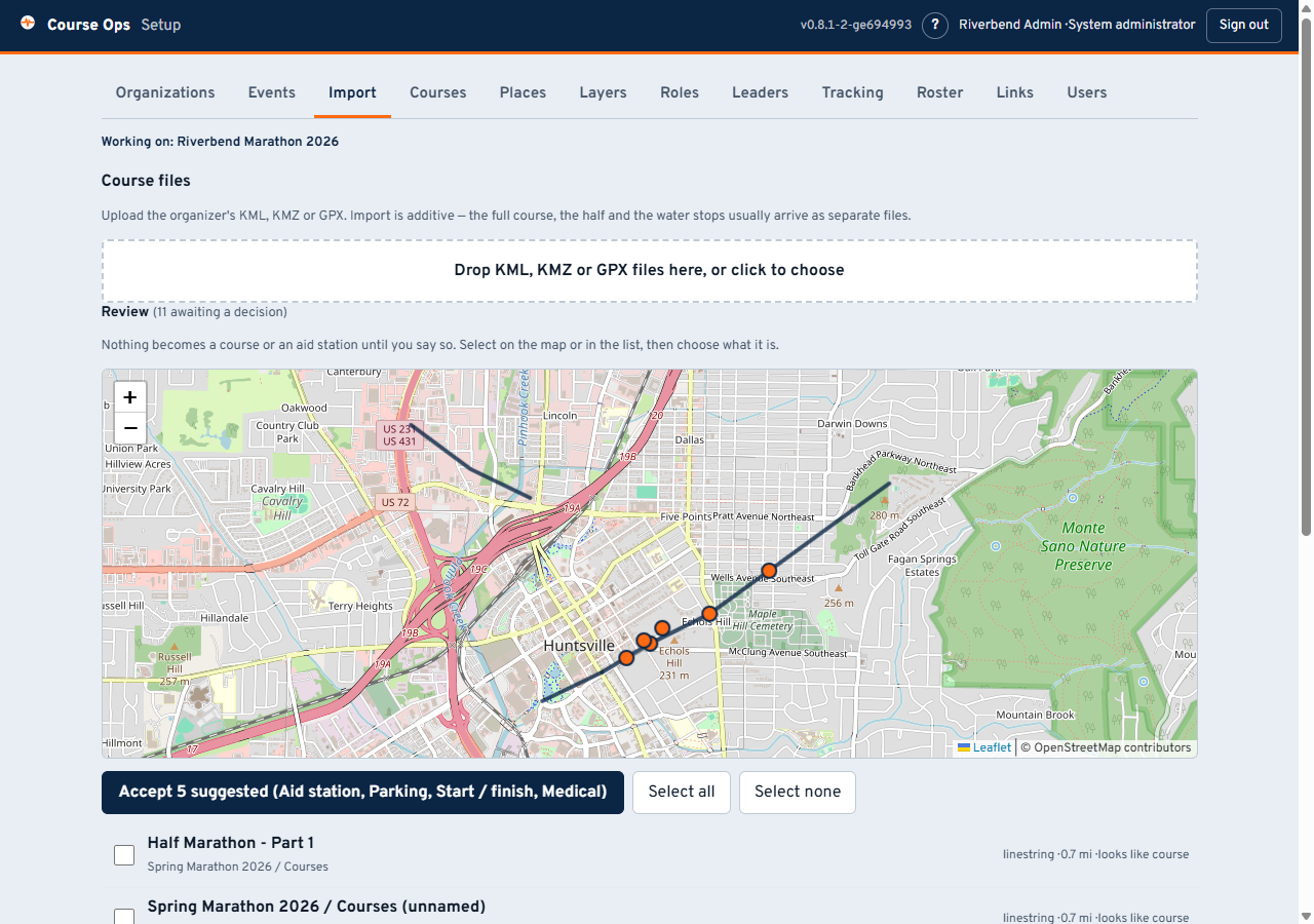
Drop in the organizer's KML, KMZ or GPX. Import is additive - the full course, the half and the water stops usually arrive as three separate files from three different tools.
Nothing becomes a course or a place until you say so. Everything lands in a review list, drawn on a map, and you classify it. That is deliberate: organizer files routinely contain a parking lot named the same as the route, and a suggestion confident enough to file it as an aid station would be wrong in a way nobody notices until race day.
The screenshot above is a real export's defects: three placemarks, all named "Example Marathon", one of them the route and two of them markers. The app says looks like course and looks like start and leaves the decision to you.
Look at the map before you assign anything. A course split into five segments, a stray line miles from the route, or a start marker in the wrong car park is obvious there and invisible in a list of names.
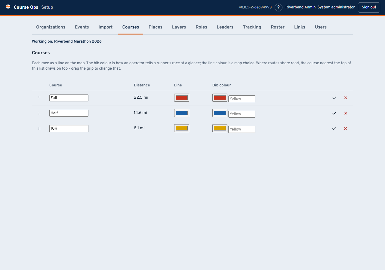
Each race gets a line colour and a bib colour, which are two different things: the line colour is a map choice, the bib colour is how an aid station operator says "first yellow male just came through".
Where routes share pavement, the course nearest the top of this list draws on top. Drag the grip to change it. That is the order everyone starts with; any viewer can re-stack their own screen without affecting anybody else.
Check the distance. If a course reads 3 mi when it should read 13, segments are missing or one belongs to a different route.
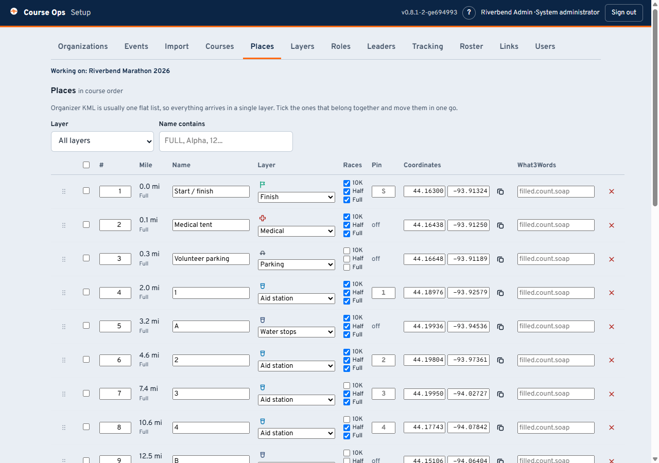
Every point on the map lives here. What each column is for:
- # - the club's own running order. Geometry cannot work this out once an event has more than one route: each place snaps to whichever line is nearest, and where races share road that is a coin flip. Drag or type to set it.
- Layer - which kind of place this is. Change one, or tick several and move them together, which is what you will do after an import (organizer files arrive as one flat list). The layers themselves are yours to invent - see below.
- Races - which races this stop serves. State it; do not let it be guessed. One water stop routinely serves three races - the organizer's file will literally say "WATER (ALL)" - and guessing drops it from every race whose line happens to run further away.
- Pin - the one or two characters drawn on the pin. Derived from the name, and only worth typing when the guess comes out wrong.
- what3words - optional, typed in by hand. Aid stations sit at park entrances where a street address is useless.
Next: Roster and links - who is out there, and how they get in.