Repository navigation
Adding raster capability to the toolchain - thoughts and concepts #558

Replies: 3 comments

|
Spec and open questions: #537.
What is theregaiaDB can now register a raster dataset and join it to
Rasters stay as Related change: variable dates can now be inferred when only a year is given (and from Code: gaiaDB Test data
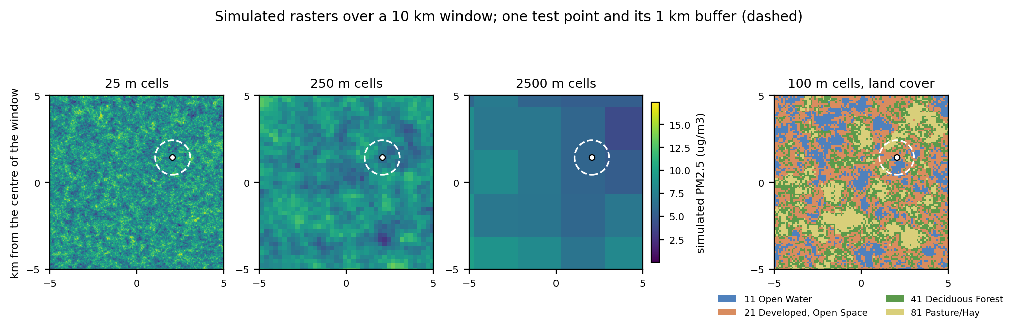
Results on the synthetic data
Not doneThe evidence #537 asks for is not in yet: timing at 1k and 10k locations, and in-database tiles against cloud-optimized files read through GDAL. Everything above is on a 10 km window, not a national raster. Questions for the group
|
|
Quick note to add evidence for validity period and in-DB or out-db. Emulated amd64 container, gaiaDB working tree of 2026-11-17, one run. What I ran
What I checked
Fixed a problem along the way
Still need to resolve
|
|
Vocab limitations for NLCD land cover classes above
Possible semantic solutions for this scenario @p-talapova
The 16 classes of the contiguous US product: 11 Open Water, 12 Perennial Ice/Snow, 21-24 Developed (Open Space, Low, Medium, High Intensity), 31 Barren Land, 41 Deciduous Forest, 42 Evergreen Forest, 43 Mixed Forest, 52 Shrub/Scrub, 71 Grassland/Herbaceous, 81 Pasture/Hay, 82 Cultivated Crops, 90 Woody Wetlands, 95 Emergent Herbaceous Wetlands. Alaska adds 51, 72, 73, 74. Whichever option, name the NLCD product the legend comes from in the concept names, in case a later product changes the class set (not checked). Questions for the vocabulary subgroup
|

Uh oh!
There was an error while loading. Please reload this page.
This is the start of a new thread to discuss raster data.
For technical implementation details, see the following issues:
#537
All reactions