Atlas map regression #608
Description
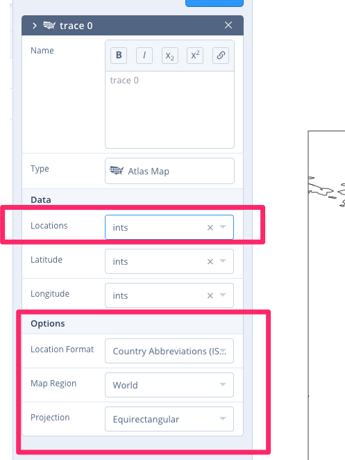
It used to be possible to change the projection of an Atlas Map/scattergeo from Create/Trace (I randomly checked an old commit 5f65565 and it works (note: I tried that commit with the then-contemporary version of plotly.js and then master with that same version, so the issue is most likely in the editor and not in plotly.js I think). Now you have to specify locations for those to show up, but that breaks the image because you can't specify points in lat/lon.
So two things:
- for Altas Maps, it's either Locations OR lat/lon and the UI should reflect that by never showing both
- the Options section should always be present (we should figure out what changed!)
Metadata
Metadata
Assignees
Labels
No labels