Here we are trying to use conditional adversarial networks to solve the general purpose solution of the image-to-image translation. This network can be used for the segmentation, coloring, or styling of an image given the dataset. Here we are trying to convert satellite images into Google map type images.
The data set was downloaded from Kaggle which was specifically made for this kind of task. it contains combine images of input and target which we split during preprocessing. You can find more details about the dataset HERE
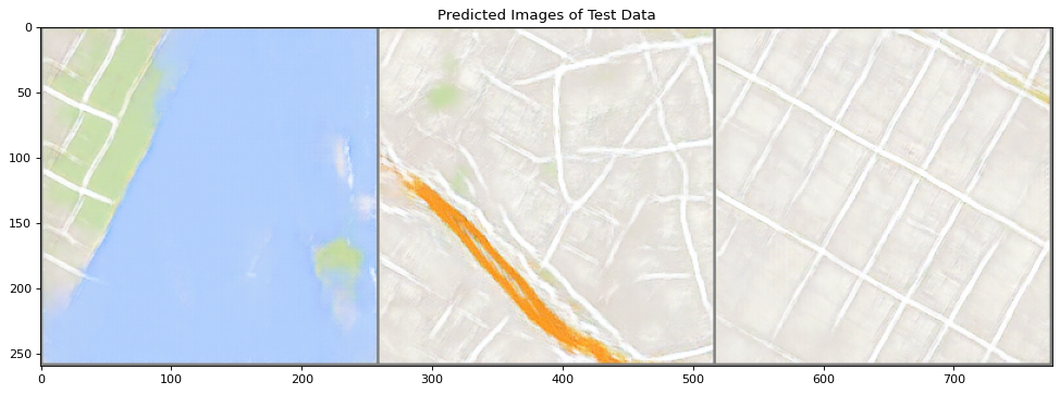
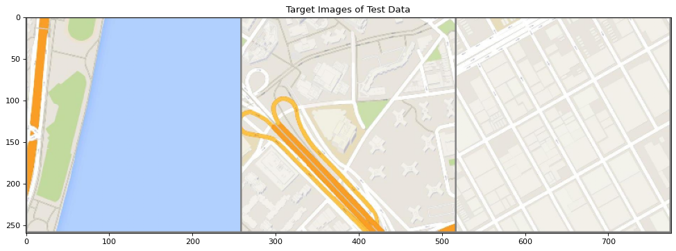
The model was trained on above-mentioned maps dataset for more than 400 epochs, the result is not that good as compared to the original paper but it can be better by tuning some hyperparameters and training for a little more. Below you can see the cherry pics that were generated by my trained model
Generated Fake Image
Target Image
Input Image

If you want to run the file make sure to edit "load checkpoint" = FALSE, and train it from scratch. In case you need the trained weights whose size is more than 1GB (that's why I didn't upload it in the repo), please feel free to reach out :)