Skip to content

studyben/SLAM_project

Folders and files

NameName
Last commit message
Last commit date

Latest commit


History

9 Commits


Repository files navigation

SLAM_project

Main function:

This code loads sensors' data, combined analysis readings from encoder, 2D lidar and FOG sensor, and generate map of surrounding environment of robot.

Usage

  1. create "sensing_data" file
  2. change the parameter in map_init.py
  3. add sensors' data file to directory
  4. run main.py

Sensing Data Usage:

Encoder: 2 * n, left wheel, right wheel
FOG: 3 * n, delta angle in x, y, z
2D-Lidar: 286 * n, obstcle location in different directions
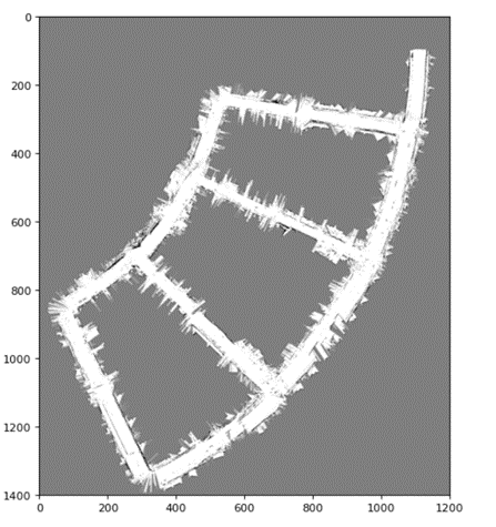
Output:

image
SLAM mapping

About

No description, website, or topics provided.

Resources

Stars

Watchers

Forks

Releases

No releases published

Packages

No packages published

Languages