AI app that has a web interface and uses 2 algorithms (Uniform Cost Search and Bidirectional Search) that calculates the optimal route between 2 cities. The app was programmed in Python (with Bottle framework), the backend side (the informations about cities, the graph between them was stored into ‘txt’ files) and, on the frontend side, the app was coded in HTML and Sass framework.
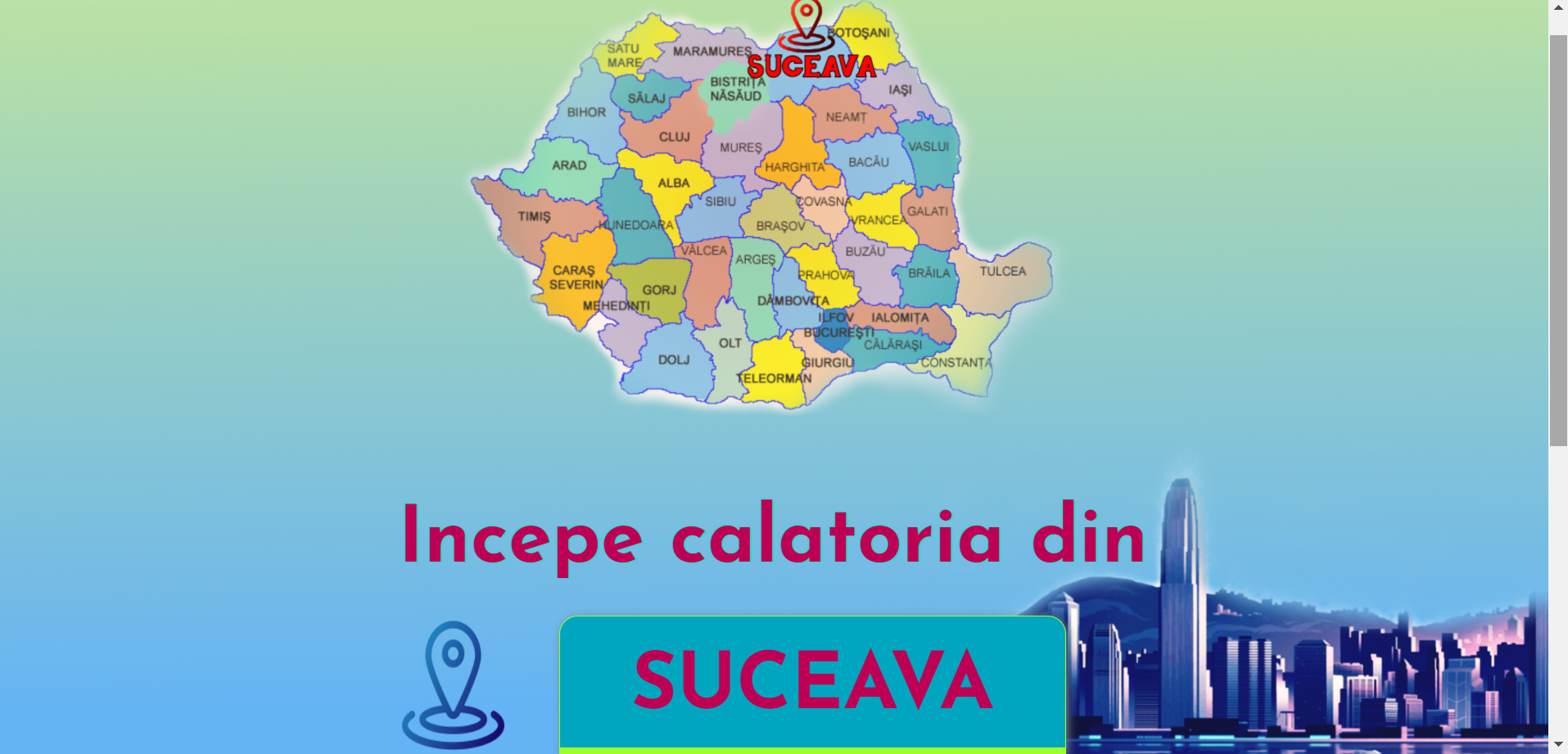
When the app starts, it will appear on the page a form with 2 input fields, one from which we want to begin travel (implicitly, the routes are starting from Suceava to other 22 cities in this country) and the other one is for the destination city. The application works only if we introduce in the second field the name of these 22 towns : Botosani, Iasi, Piatra Neamt, Vatra Dornei, Bistrita, Satu Mare, Bacau, Miercurea Ciuc, Brasov, Galati, Constanta, Bucuresti, Craiova, Targu Jiu, Sibiu, Cluj-Napoca, Targu Mures, Alba Iulia, Hunedoara, Oradea, Arad, Timisoara.


On the same page, a bit lower from input fields are appearing the informations about:
- Number of kilometers between Suceava and inserted city
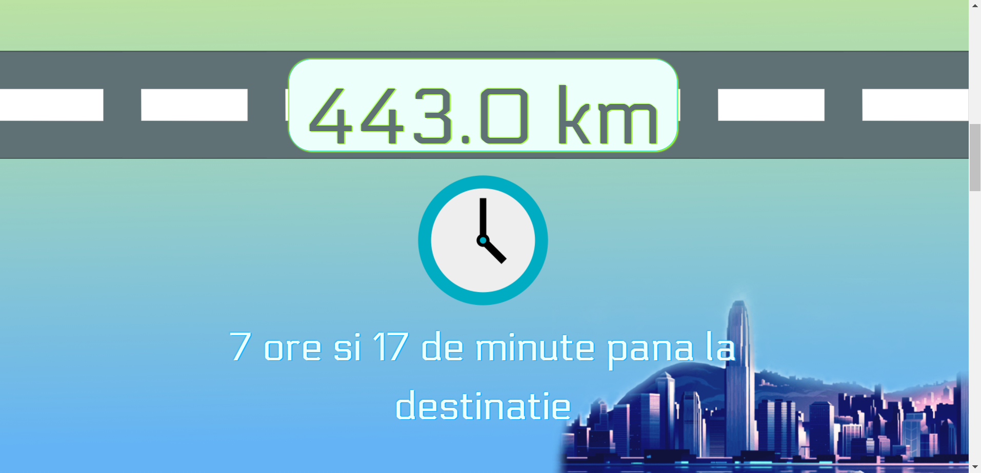
- The hours and minutes to destination
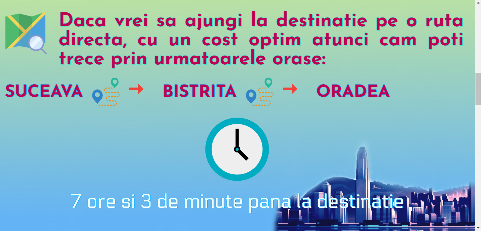
- For some cities will appear the optimal way, a directly route with a minimum of kilometers and the name of the cities where the driver can pass
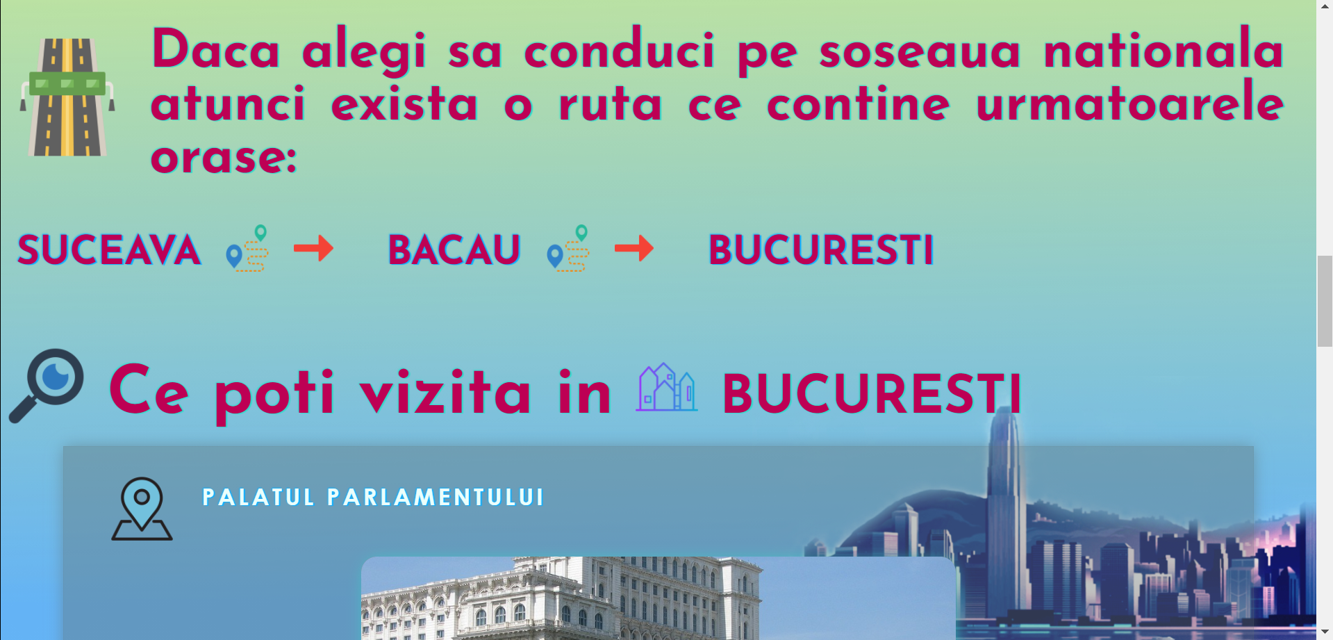
- Still here, it will appear the name of the cities that national streets are passing through them, so the driver will know which cities has national streets

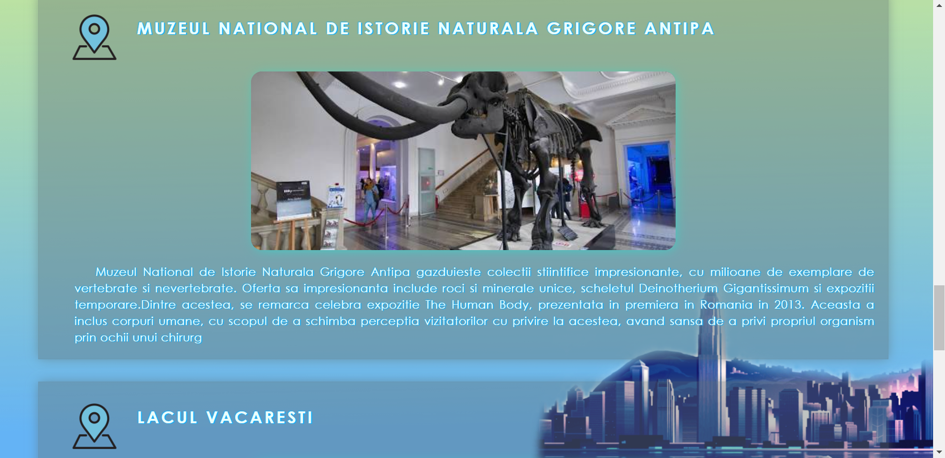
- When the traveler arrives to destination, he can read a few info about the main sights of that town, thereby visit them.
Watch video to see how it's work: