Skip to content

Customize distance matrix based on road adjacency, daily speed profiles (using dynamic time warping), and geolocations to cluster road networks in order to develop different models to predict future speeds

Notifications You must be signed in to change notification settings

CakeBnut1996/spatial-clustering

Folders and files

NameName
Last commit message
Last commit date

Latest commit


History

3 Commits


Repository files navigation

Road Segments Classification Based on Spatial Patterns

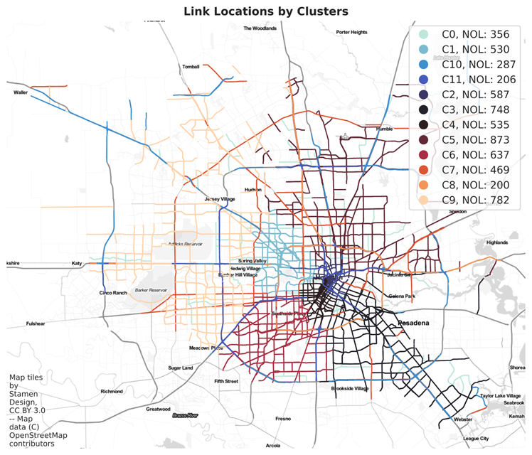
Brief description: Customize distance matrix based on road adjacency, daily speed profiles (using dynamic time warping), and geolocations to cluster road networks in order to develop different models to predict future speeds

Data source: INRIX (not included in the data)

Objective

  • To group links whose have similar traffic patterns together.
  • To get more accurate predictions by modeling different patterns separately

Spectral Clustering Attribute: Evaluating whether 2 links are in the same group by

  • Similarity of historical daily speed and congestion patterns,
  • Whether belong to the same functional class
  • Euclidean distance
  • Whether reachable within 20 links

Results: image

About

Customize distance matrix based on road adjacency, daily speed profiles (using dynamic time warping), and geolocations to cluster road networks in order to develop different models to predict future speeds

Resources

Stars

Watchers

Forks

Releases

No releases published

Packages

No packages published