meteocool is a free GIS visualisation & aggregation platform with focus on severe weather. Optimized for mobile devices, you can use it to both chase or avoid upcoming weather - that's up to you.

meteocool currently uses radar data provided by DWD and realtime lightning information from the awesome blitzortung.org project.


- Automatic Map Updates: the biggest inconvenience with most weather radar visualisations is out-of-date data. Meteocool notifies its clients as soon as new radar data becomes available and the client tries to be transparent about the dataset age. Say goodbye to hammering F5!
- Live Lightning Strikes: new lightning strikes are displayed instantly, giving you an even better feeling for the cloud formation's intensity, trajectory and speed.
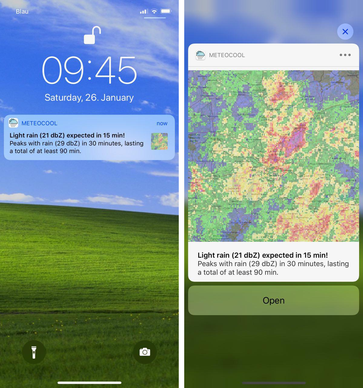
- Push Notifications: get notified about incoming rain up to 60 minutes in advance. Works in any modern browser and on iOS.
- Dark Mode: great for HUD-like displays and general night time usage.
- Progressive Web App: responsive, connectivity independent and app-like. Add a shortcut to your iOS or Android Home Screen to use meteocool in "app mode".
- iOS & Android Apps: native iOS and Android apps provide battery-efficient background location services to allow for accurate rain notifications without user interaction.
