The purpose of this project is to provide travelers with a tool to determine their travel destination based on weather conditions and search for hotel information for cities across the world. PLANMYTRIP is a top travel technology company that specializes in internet-related services in the hotel and lodging industry. Jack is the head of analysis for the user interface team and requested help to collect, analyze and present data for customers via the search page, which can be filtered based on their preferred travel criteria in order to find their ideal hotel, anywhere in the world. Several resources such as google open resource and open weather maps were utilized via API key and dependencies that were required to get the required data about cities based on latitude and longitudes, and weather were also imported before proceeding with constructing the analysis tool.
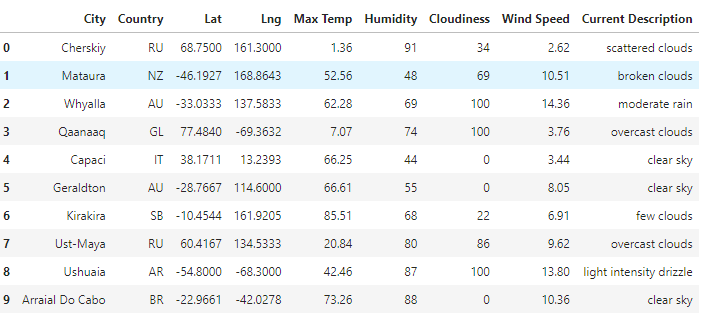
2000 random latitudes and longitudes, were generated to retrieve nearest city information and API call was made to OpenWeatherMap. Weather information was collected for the city for
- Latitude and longitude
- Max temperature
- Percentage humidity
- Cloudiness,
- Wind speed
- Weather description
Csv file was generated from the query tool. Sample data is shown below
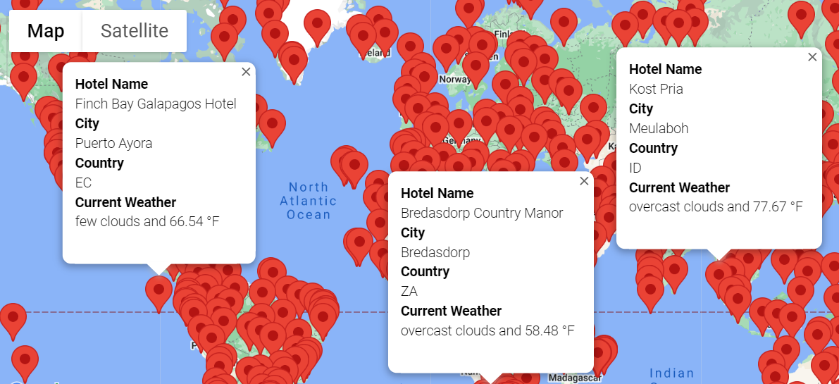
Google API key, weather CSV file resulting from weather Database query tool was imported along with dependencies to get the hotel information. The query tool was build such that initially it filters cities in desired temperature range, dropping the cities which had any empty rows, and then selecting hotel information through for loop, skipping a city if hotel information was not found. A csv was created which stored this clean data and markup map was created so that city name, country code and weather description with max temperature was shown in the pop up.
Sample of few markups for worldwide hotel data retrieved
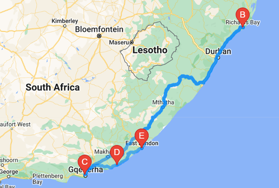
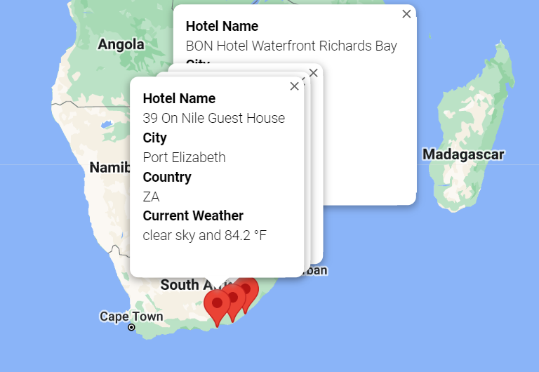
Travel itinerary map was then created and this query tool can be used to select specific route such as walking cycling or driving, and depending on cities selected with start and end city being the same this tool would display the route in map and also in the marker layer map the pop up displayed the hotel name, city, country and weather description with maximum temperature.
The tool depending on weather conditions, hotels information retrieved and the cities and route chosen for certain minimum and maximum temperature inputted by traveler , can be repurposed and used for any selection so that traveler can make informed decision for travel destination and travel itinerary.