The topic of my research is to estimate whether Single-Family Zoning Restrictions (commonly referred to as "R1 zoning restrictions") influences resedential segregation in the Baltimore Metropolitan Area by spatially seperating poor and non-poor residents. For this project, I am specfically comparing single-family zoning in Howard County to the number of poor people residing in different Census tracts.
To do my project, I will create zoning maps that details where single-family zoning restrictions are present across the Baltimore region and then compare it to demographic data obtained from the Maryland Census that shows characteristics of neighborhoods that either do or do not have single family zoning restrictions. For this project, Zoning data was obtained from Real Property Datasets available at from the Maryland Department of Planning, while data on community characterstics was obtained from the 2018 ACS survey.
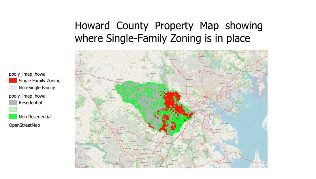
The only transformations necessary will be when creating maps that detail Maryland's zoning policy for different counties. For this first project, I am only choosing to analyze data from Howard County, MD.
My overall project will compare the ratios of both rich to nonrich populations and poor-to-nonpoor populations within the various census tracts. Once these variables have been obtained, regresson analysis will be performed to estimate the relationhship existing between the proportion of Single-Family zoning in a census tract the proportion of poor and rich people present in that census tract. My model will attempt to control for factors such as educational attainment, hosuing costs, race, and unemployment. My unit of analysis for the study will be the individual census tracts that make up the 7 counties in the Baltimore Metropolitan Statistical Region (Carroll County, Howard County, Queen Anne's County, Harford County, Baltimore County, Baltimore City, Anne Arundel County)
However, because this is only my first project I chose to just compare the total amount of single family zoning present in Howard County to the total number of people making less than $30,000/yr in each census tract (essentially calculating the number of poor people in a given area).
The outputs for my overall project would be both the ratio variables indicating the proportion of rich and poor populations, as well as a variable estimating the proportion of resedential property that has single-family zoning restrictions.
For this first project, my outputs will be the values I receive for the total population making less than $30,000/yr, as well as the values showing where single family zoning restrictions are present.