


Crowd Count is a browser-only crowd-size estimator. Draw a polygon on a real-world map or an uploaded indoor floor plan, pick a crowd density — uniform or a linear gradient — and the tool multiplies area by density and benchmarks the estimate against codified safety thresholds (UK Purple Guide, Green Guide, NFPA 101, Still's upper safe limit). Version 2.0 adds a full 3D site view with instanced crowds, optional Google Photorealistic 3D Tiles, and animated 3D density references.
The whole tool runs entirely in your web browser. There is no installation, no backend, no Python environment, and no build step.

Disclaimer: No responsibility is taken for the use or output of this tool. All results are Fermi-style order-of-magnitude estimates and must be independently verified by a qualified safety professional before use in any design, planning, or regulatory context.
 Prof Rino Project lead and developer |
 Yingying Project collaborator |
Pure client-side — no installation, no backend. The entire app builds to a
static dist/ folder you can drop on GitHub Pages, Cloudflare Pages, Netlify
or any CDN.
- Outdoor mode. MapLibre GL JS on top of OpenStreetMap tiles, with a free Esri satellite imagery toggle, optional Google roadmap and satellite basemaps (bring your own API key), an OSM Nominatim search box, and a live metric/imperial scale bar.
- Indoor mode. Upload any JPG/PNG floor plan, click two points, enter a known real-world distance, and the image becomes a calibrated drawing surface in true m² (or ft²).
- Density gradients. Each zone can be uniform or a piecewise-linear gradient through any number of distance/density points along a draggable direction. Totals use exact integration over the real zone geometry (minus obstructions); safety warnings use the peak density.
- Multi-zone management. Name, colour, and a density slider per zone. Editing one zone does not reshuffle the others; sampled person positions are cached per zone.
- Crowd appearance. Neutral, by-zone, or natural-mix people colours with separate head, torso and leg tones; random orientation or Aim crowd to face everyone in a zone towards a draggable point.
- Codified safety thresholds. Per-zone pass / approaching / over-limit
badge against any of:
- UK Purple Guide — 2.0 ppl/m² planning ceiling for outdoor mixed-audience events
- UK Green Guide (standing terrace) — 4.7 ppl/m²
- NFPA 101 standing assembly — 5 net sq ft per person = 2.15 ppl/m²
- Still upper safe limit — 5.0 ppl/m²
- Full 3D site view. Switch the whole site into 3D: instanced crowd
rendering built for very large crowds, 3D zones and obstructions,
synchronized 2D/3D switching, orbit/pan/zoom mouse controls, WASD keyboard
navigation, grayscale and colour display modes, and looping cinematic
camera moves (Orbit, Flyover, Sweep, Push, Drone, Skim). Press
Hfor a crowd wave. - Google Photorealistic 3D Tiles. Optional photorealistic terrain and buildings in the 3D view via the Google Maps Platform, with terrain-height sampling so the crowd stands on the real ground. The API key is stored only in the browser's localStorage — never in project files or share links.
- Crowd visualisation. Top-down head-on-shoulders person symbols rendered at real-world scale via a jittered-grid sampler — now up to 200,000 rendered people per zone, with improved sampling for circles, concave polygons, and polygons with holes. Symbols stay at consistent geographic size as you zoom.
- 3D density reference. Side-by-side 3 m × 3 m reference patches for 1–6 people/m², as procedurally generated mannequins or animated crowd models (streamed from this project's GitHub release).
- Ruler. Multi-point measuring with confirmed distance, live preview to the cursor, projected total, and explicit Done / Clear actions.
- Metric / imperial toggle for the scale bar, area display, and indoor calibration distance.
- Save / Open and fflate-compressed permalink. The full state — zones, densities, gradients, crowd appearance, aim points, view, basemap, governing standard — saves to a local project file or encodes into the URL fragment so a single link reproduces a session exactly. Older project files and share links keep working. No backend.
- Polyline undo.
Ctrl+Z/Cmd+Zremoves the last vertex while drawing.
You have two equally simple ways to run the app — both with no installation, no account, and no server.
Just open the link in Chrome, Edge, Firefox, or Safari and start drawing. That's it.
Download crowd-count.html — one single file, about 2.5 MB — from the Releases page. Save it anywhere on your computer, then double-click it. The app opens straight in your default browser, no server, no install. You can email it to a colleague, put it on a USB stick, or keep it on an air-gapped laptop.
An internet connection is needed for the map tiles (street map, satellite background, 3D basemaps), the place-search box, the optional Google features, and the animated 3D density references (large models streamed from the Crowd Count website) — everything else (drawing, density, person rendering, indoor floor plans, save/open, sharing via permalink) works fully offline.
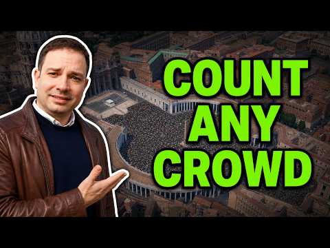
A short walk-through showing how to draw zones, set densities, and read the estimate:
If you want to fork the code, audit it, run a local copy, or contribute changes:
- Clone and run the dev server:
git clone https://github.com/ProfRino/crowd-count.git
cd crowd-count
npm install
npm run dev        # http://localhost:5173
- Build a production bundle:
npm run buildproduces a static site indist/that deploys cleanly to GitHub Pages, Cloudflare Pages, Netlify or any static host. - Single-file build:
npm run buildproduces a self-containeddist/index.html(~2.5 MB) plus a byte-identicaldist/crowd-count.htmlthat double-clicks straight into any browser viafile://. Theindex.htmlcopy is what GitHub Pages serves; the renamedcrowd-count.htmlis the one attached to each GitHub release. All assets — JS, CSS, fonts, the favicon, the 3D mannequin — are inlined viavite-plugin-singlefile. - Animated crowd models: the six animated GLB references (~430 MB
combined) are too large for the repository — two exceed GitHub's 100 MB
per-file limit — so they are attached to the
v2.0.0 release
as individual assets. The deploy workflow stages them from there into the
GitHub Pages site, and the app streams them from that site whenever no
local copy is served. For local development, download them into
public/crowd-models/— the app always tries the local path first.
The GitHub Actions workflow at .github/workflows/deploy.yml rebuilds and
redeploys the hosted version on every push to main, staging the animated
crowd models from the release assets into the site. The single-file
crowd-count.html build is attached to each tagged GitHub release.
Vue 3 + Vite + Tailwind CSS + MapLibre GL JS + Three.js + 3d-tiles-renderer + Turf.js + earcut + fflate. MIT-licensed.
If you reference this work, please cite:
Lovreglio, R. Crowd Count. Massey University. https://github.com/ProfRino/crowd-count
A machine-readable CITATION.cff is included in this
repository — GitHub renders it as a "Cite this repository" button in the
sidebar.
MIT — © 2026 Rino Lovreglio.