Repository navigation
Device Maps
Save a regular trip, refresh it when you need an estimate and view the result on a Homey device. To keep the saved trip unchanged, select the device's one-off action. If you only need to compare a fresh estimate to a limit, the app condition needs no device.
- Complete Google Maps setup.
- Choose Add device → Google Services → Maps. In Set up your Maps route, set Origin and Destination. Select a Google suggestion, or choose Use typed address for a full address or
latitude, longitude. You can use Homey's location for either endpoint instead. This uses the location set on Homey, not your phone or car's live location. Coordinates are sent to Google when you refresh. - Choose Travel mode: Driving (with traffic) (default), Public transit, Walking or Cycling. Leave the image options on only if you want them and have configured the necessary APIs. Select Continue, then add the listed device.
- Open your device and press Refresh route. Check travel time, distance and Last refreshed. To see the image, open the device's Google Maps route camera image.
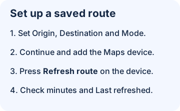
Illustration: saving a route does not calculate it. Press Refresh route to get the first estimate.
| Setting | Default and effect |
|---|---|
| Origin / Destination | Empty until configured. Enter an address or decimal coordinates. Latitude must be −90 to 90 and longitude −180 to 180. |
| Use Homey's location as origin / Use Homey's location as destination | Off. When enabled for an endpoint, Homey's coordinates override the address there. |
| Travel mode | Driving (with traffic). Google may not offer every mode for every trip. |
| Show route image | On. Also requires the app-wide image option and Maps Static API. |
| Show traffic on route images | On. Applies to driving images when both app and device allow traffic colors. See cost and options. |
- Google Maps travel time: minutes rounded to one decimal place; Google Maps distance: kilometers rounded to two.
- Google Maps estimated arrival: estimated time at the request plus Google's duration, shown in Homey's time zone. The refreshed trigger supplies an ISO 8601 timestamp in UTC instead.
- Estimated traffic delay: for driving, the difference between the estimate and Google's traffic-free baseline, rounded to one decimal place and never negative. It is blank when Google does not supply a usable traffic-aware comparison. The reading does not need traffic colors.
- Last refreshed: date and time of the last successful refresh, in Homey's time zone.
The app does not poll. Refresh with the device button or the saved-route action. If a calculation fails, prior readings can still be present; check the timestamp or use the error branch. A successful calculation does not guarantee an image. Homey asks for the image when needed, then reuses it until the next refresh; if the request fails, refresh to retry. An image without traffic data or with a route too detailed to color can show a blue route. Turning off images in app settings blocks image requests; refresh after changing image options.
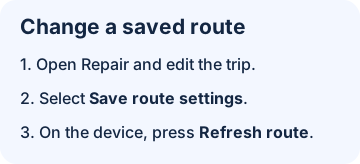
Illustration: save the new route in Repair, then refresh it on the device before reading the estimate.
Open the device's Repair screen to choose new suggestions or type addresses, then select Save route settings. In Advanced Settings you can enter addresses and coordinates directly; don't paste a place ID there. If Repair cannot recover a previously saved location, enter or select it again. Changing endpoints, location switches, mode or the device image toggle can clear the existing readings. For a traffic-color-only change, the new option applies on the next refresh. Press Refresh route and check Last refreshed.
Next: check a saved trip with a Flow or browse Maps Flowcards.