-
|
Is it possible to parse the data in the HGT hillshading files to make the Cruiser map "elevation aware"? I find this information very useful, and have been a little spoiled with BaseCamp offering real-time Lat/Lon+Elevation as I move my mouse. Originally posted by @MotoUKRider in #558 (comment). |
Beta Was this translation helpful? Give feedback.
Replies: 5 comments 33 replies
-
|
@MotoUKRider Thanks for the suggestion. It is possible if we implement it first in Mapsforge: 🙂 It is also possible to request BRouter (offline) data for elevation information. |
Beta Was this translation helpful? Give feedback.
-
|
@MotoUKRider Does BaseCamp use the same hill shading data? |
Beta Was this translation helpful? Give feedback.
-
|
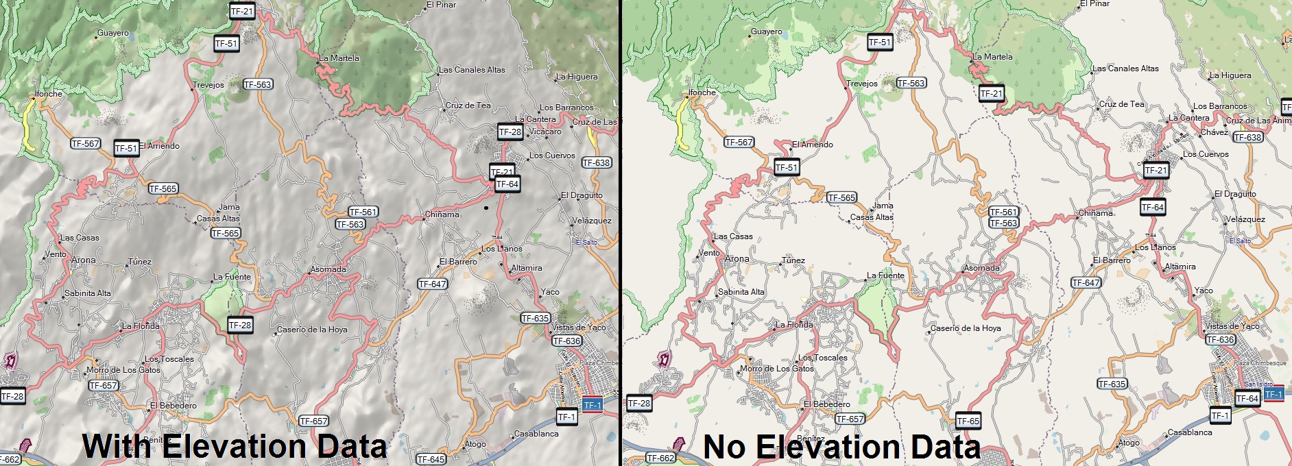
@devemux86 Yes, that's why I have all the HGTs on my computer - There's an extra couple of parameters in the mkgmap command that turns a basic map into a hill-shaded map with elevation data (before vs after example). |
Beta Was this translation helpful? Give feedback.
-
|
Next version will show the elevation at all available locations on the map using the BRouter (offline) data: 
|
Beta Was this translation helpful? Give feedback.
-
|
Also note that we are limited by the operating system. |
Beta Was this translation helpful? Give feedback.
-
|
My suggestion is something simple like with a hyphen: At waypoints where we display distance/time to the previous/next via point and the start/end, |
Beta Was this translation helpful? Give feedback.
-
|
Perhaps square-brackets as the delimiter? |
Beta Was this translation helpful? Give feedback.
-
|
|
Beta Was this translation helpful? Give feedback.
-
|
Why all these changes ? Keep as is, simple. |
Beta Was this translation helpful? Give feedback.
-
|
Show elevation at all locations on the map is available in: It works via long press on the map. |
Beta Was this translation helpful? Give feedback.
-
It works via long press on the map. |
Beta Was this translation helpful? Give feedback.
It works via long press on the map.