User Settings
The Settings page lets you personalise every aspect of TREK — appearance, maps, notifications, offline behaviour, and your account.
Open the user menu in the top navigation bar and select Settings. The page opens on the General tab by default.
If your account requires MFA setup, TREK redirects you directly to the Account tab (via ?mfa=required).
| Tab | Purpose | Shown when |
|---|---|---|
| General | Currency, language, temperature unit, distance unit, time format, booking route labels, map POI pills, and blur booking codes | Always |
| Appearance | Color mode, color scheme / accent, readability (transparency, reduce motion, density, text size), and which widgets appear on your dashboard | Always |
| Map | Map provider (Leaflet, Mapbox GL, or MapLibre GL), tile presets, map style and Mapbox token, 3D buildings, high-quality mode | Always |
| Notifications | Email, webhook, ntfy, and in-app notification preferences | Always |
| Integrations | Photo providers (Immich, Synology, etc.) and MCP OAuth clients / API tokens | Only when the Memories or MCP addon is enabled |
| Plugins | Per-user settings for installed plugins | Only when at least one plugin is installed |
| Offline | Cached trips, pending changes, re-sync and clear cache | Always |
| Account | Username, email, password, MFA (TOTP + backup codes), avatar, delete account | Always |
| About | App version, links to Ko-fi / Buy Me a Coffee / Discord / GitHub (bug reports, feature requests) / Wiki | Only when version metadata is available |
The General tab controls the following preferences, all saved immediately on change. See Display-Settings for the detail.
Language & region
- Currency — your display currency; Trip currency (the default) shows each trip in its own. See Currencies.
- Language — displayed as a button grid on desktop and a dropdown on mobile.
- Temperature unit — Celsius (°C) or Fahrenheit (°F).
- Distance unit — Metric (km) or Imperial (mi).
- Time format — 24h (14:30) or 12h (2:30 PM).
Travel & map
- Booking route labels — show or hide station / airport names on booking route endpoint markers.
- Explore places on the map — show a POI category pill on the trip map for finding nearby places from OpenStreetMap.
- Blur booking codes — blur confirmation codes and reference numbers (useful when screen-sharing).
- Color mode — Light, Dark, or Auto (follows your operating system / browser preference).
- Color scheme — a preset accent, or Custom with your own light and dark accent colors.
- Readability (Experimental) — transparency, reduce motion, density, and text size.
- Dashboard widgets — which widgets appear on the dashboard, independently for desktop and mobile.
See Appearance-Settings for the detail.
The Map tab requires an explicit Save action after making changes.
Provider — choose between:
- Leaflet — Classic 2D raster tiles. You can pick from built-in presets (OpenStreetMap, OpenStreetMap DE, CartoDB Light/Dark, Stadia Smooth) or enter a custom tile URL template.
-
Mapbox GL (Experimental) — Vector tiles with 3D buildings and terrain. Requires a public Mapbox access token (
pk.*). Supports built-in style presets (Mapbox Standard, Standard Satellite, Streets, Outdoors, Light, Dark, Satellite, Satellite Streets, Navigation Day, Navigation Night) or a custommapbox://styles/USER/IDURL. Additional options:- 3D Buildings & Terrain — Pitch and real 3D building extrusions (works on every style including satellite).
- High Quality Mode (Experimental) — Antialiasing + globe projection for sharper edges. May impact performance on lower-end devices.
-
MapLibre GL — Vector tiles from OpenFreeMap, and the reason to pick it over Mapbox GL: it needs no access token. Styles are OpenFreeMap Liberty, Bright, and Positron, or any
https://tiles.openfreemap.org/…style URL. The 3D and high-quality toggles are Mapbox-only and are not shown here.
Each GL provider keeps its own saved style, so switching between Mapbox GL and MapLibre GL never overwrites the other one's choice.
Atlas always uses Leaflet regardless of the provider setting.
Opening view — there is no default map center or zoom setting. Every map frames itself on the places it is showing. See Map-Settings.
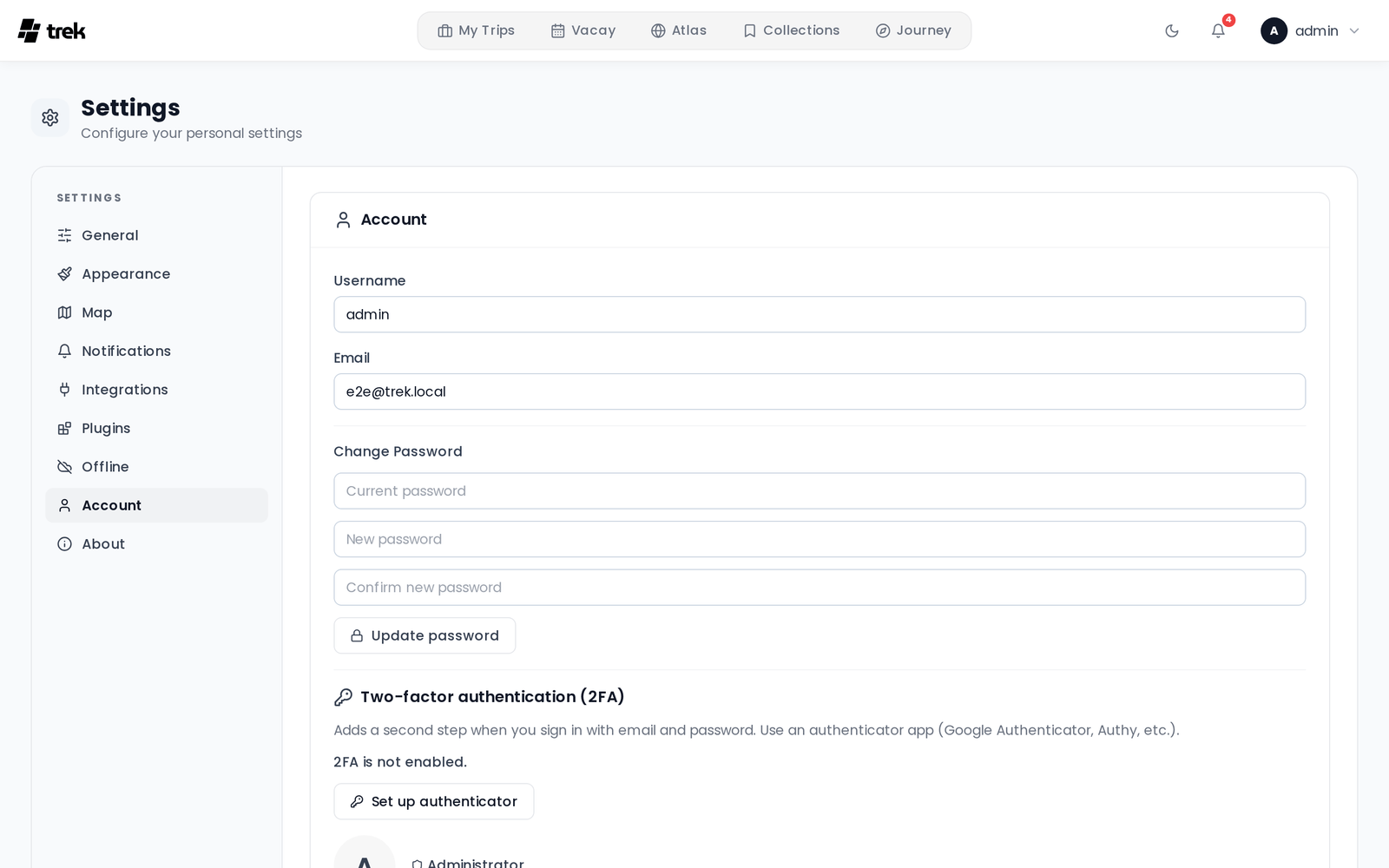
The Account tab lets you:
- Edit your username and email address.
- Change your password (hidden when the server runs in OIDC-only mode — see OIDC-SSO).
- Set up or disable two-factor authentication (TOTP). After enabling MFA, backup codes are shown once and can be copied, downloaded, or printed. See Two-Factor-Authentication.
- Upload or remove your profile avatar.
- Delete your account (irreversible; blocked if you are the only admin).
If your account was linked via SSO, an SSO badge appears next to your role and the OIDC issuer domain is shown below it.
The Integrations tab is only visible when the Memories or MCP addon is enabled. It contains:
- Photo Providers — Configure Immich, Synology Photos, and other photo integrations (always shown when the Integrations tab is visible).
-
MCP section (only when MCP addon is enabled):
- Shows the MCP server endpoint URL.
- OAuth Clients sub-tab — Create and manage OAuth 2.1 clients (with redirect URIs and scopes). Quick-fill presets are provided for Claude.ai, Claude Desktop, Cursor, VS Code, Windsurf, and Zed. Active OAuth sessions can be viewed and revoked here.
- API Tokens sub-tab (Deprecated) — Create and manage personal bearer tokens for direct MCP access.